Boston North Shore Study
Regional Saugus River Floodgate Project - Everett, Lynn, Malden, Revere and Saugus, Massachusetts


The Study and Project
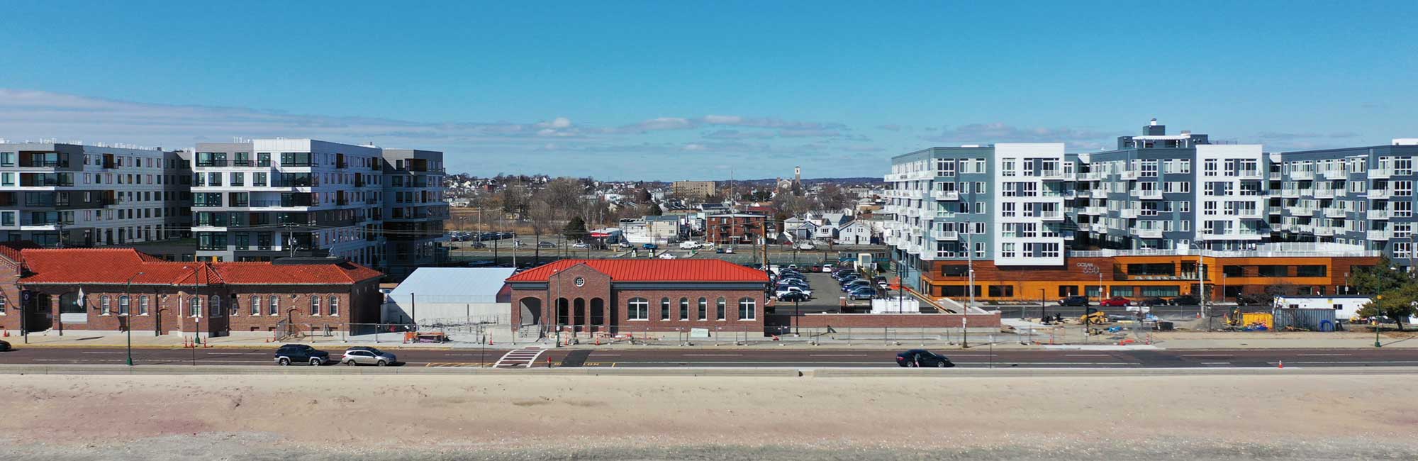
 The Regional Saugus River Floodgate Project is the primary option to regional protection which is being re-evaluated and updated in the Boston North Shore Study. The project is a coastal flood protection project to provide a very high level of protection to the Cities of Revere, Lynn, Malden and Everett, and the town of Saugus, Massachusetts. The region, five (5) miles north of Boston, is the most vulnerable area along the Massachusetts coast to storm surge flooding and sea level rise.
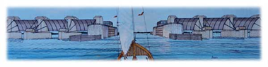
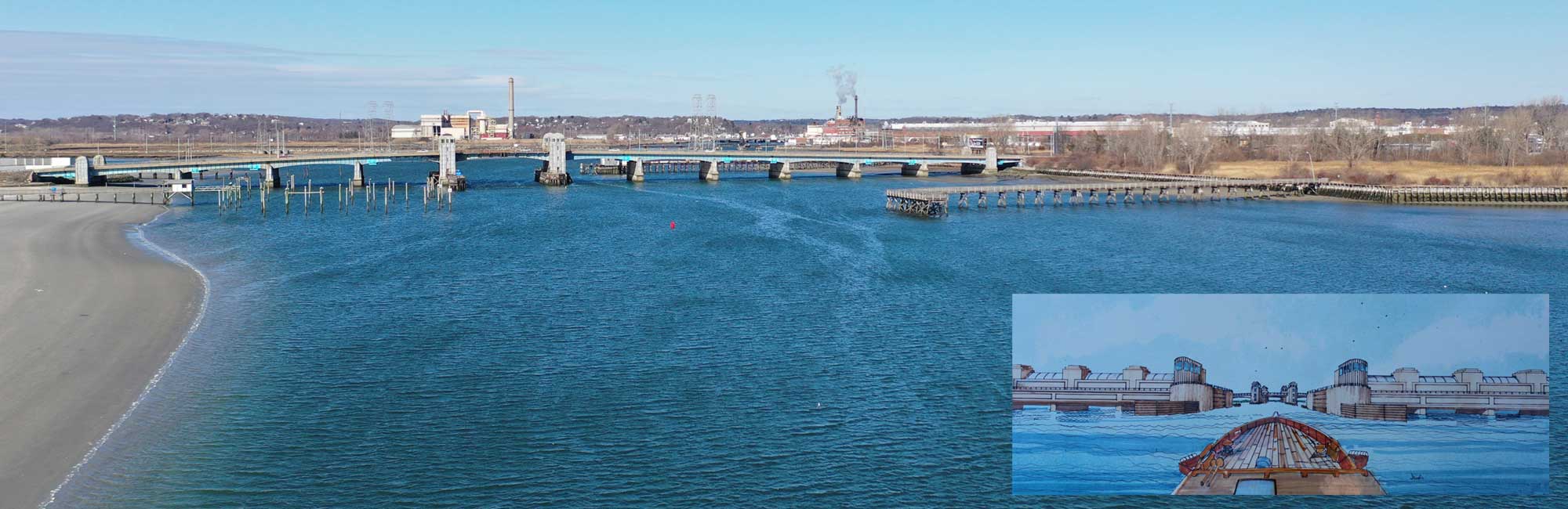
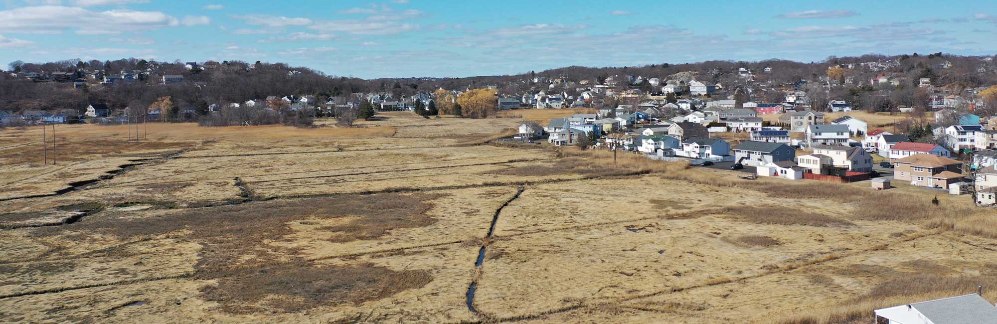
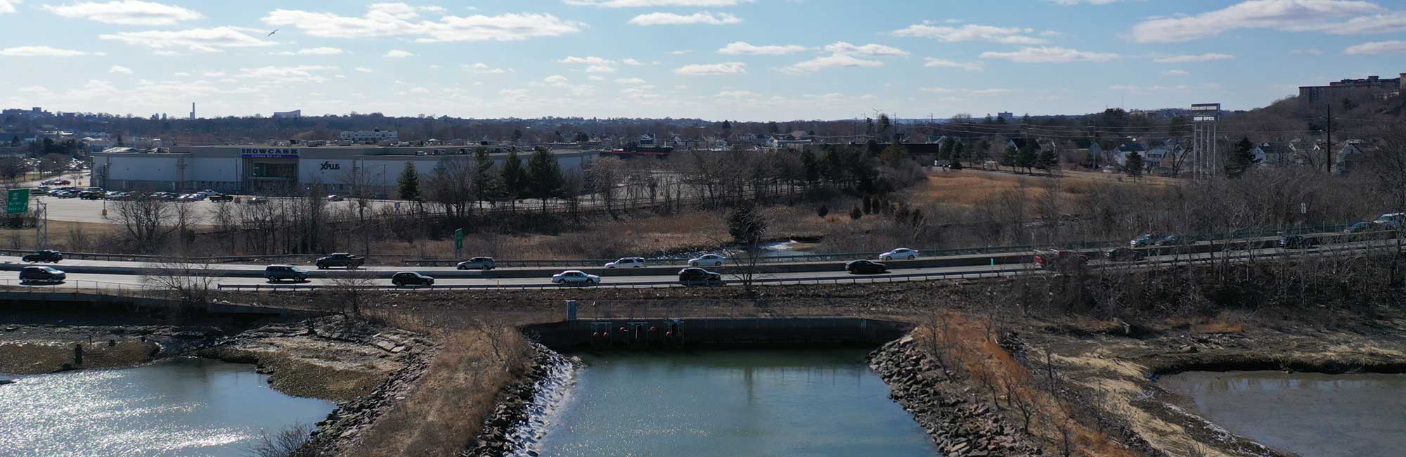
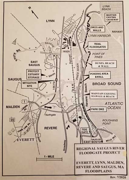
The US Army Corps of Engineers New England Division investigated solutions to the problem with 5 Steering Committees over 4 years ($2.6 million). The Recommended Regional Project includes a Floodgate structure at the mouth of the Saugus River with nine (9) gated openings 500 feet wide, designed to provide safe passage for navigation and the natural tide levels and flushing in the 1,650 acre tidal Estuary landward of the gates. The Estuary would be purchased and managed to protect its flood water storage and environmental resources. The gates would be tied to 3.1 miles of shorefront improvements along Lynn Harbor, Point of Pines and the Revere Beach Reservation. It would protect 5,000 buildings, 8,000 housing units, 10,000 residents, 20,000 employees and 400,000 commuters in the region against the worst coastal storm likely to occur and against sea level rise, estimated damages at $ 1.3 billion.
With 1.5 feet of sea level rise from 1980 to 2050, the SPN floodplain would increase from 5,000 buildings to about 6,000 buildings that would be protected by the project. The increase is attributed to both an estimated growth in development of about 4%, and an increase in the SPN floodplain by 2050 since the 1980 period of about 1.5 feet.
Building Locations SPN Floodplain SPN Floodplain & Estimated 4%
In 1990 Report 1-ft Sea Level Rise Growth TOTAL
City of Revere 2,670 340 110 3,120
Town of Saugus 900 150 40 1,090
City of Lynn 1,200 150 50 1,400
City of Malden 210 40 10 260
City of Everett 100 20 -- 120
TOTAL 5,990
Building sand dunes at Point of Pines and along Revere Beach using the I-95 sand could also reduce overtopping along Revere Beach. The use of this sand could remove 4,900 feet of the embankment restoring 16.7 acres of ecosystem habitat and restore flushing to the upper estuary. Breaching and removing the I-95 embankment to restore the wetlands is a major goal of resource agencies.
The Secretary of Environmental Affairs after the NEPA/MEPA review provided a positive Certificate, the Commonwealth then supported it, and the US Congress authorized the Project for construction. Then in the fall of 1993 a new Secretary of Environmental Affairs, an environmental activist from Rhode Island, was opposed to construction along the Massachusetts coast and the project was stopped, and since it has been de-authorized. Renewed interest in the Project by the communities due to coastal flooding and accelerated sea level rise has resulted in the Boston North Shore Feasibility Study which was authorized by the President on 23 Dec 2022 to investigate the flooding and ecosystem needs of the region.
Project Status & Updates
GENERAL
Revere officials and others requested Senator Edward Markey to sponsor legislation for a regional investigation for coastal flood protection and environmental enhancement, which he and Representative Katherine Clark did in the Water Resources Development Act of 2022, which President Biden signed with the National Defense Authorization Act on 23 Dec 2022. Funding is now needed for this Boston North Shore Study from both the Federal and state governments in order to sign a cost sharing agreement for the study. When funded to the Corps, this new study is expected to be called "Saugus River Coastal Storm Risk Management Feasibility Study" , and was initiated by a joint letter request by the five communities. The Feasibility study process would develop, evaluate and update alternatives and impacts. Public involvement is required in order to evaluate alternatives and environmental concerns and to renew support from the Commonwealth and communities. This support and an approved Feasibility Report and EIS/EIR are required before the design process can resume. The City of Revere has taken the lead for the region. Since no funding is in the Corps budget for this fiscal year, and it's uncertain when funds will be made available, it has been recommended that Revere officials consider obtaining state and local funds, and then, in coordination with the Corps and with their oversight, proceed with the study, which would show strong and renewed commitment by the Commonwealth. It is reminded that the Federal government spent over $8 million on this project only to see the Commonwealth retract on their sponsorship. The region is facing extensive flooding with accelerated sea level rise and frequent storms with more intense flooding approaching in the 2030s, and since it will likely take until then before a Regional project can be completed.
3-4-24 US Congressman Seth Moulton and State Representative Jessica Giannino attended a meeting in Saugus with their aids, the Town Manager and Board of Selectmen from Saugus, business owners, organizer Peter Manoogian, and the Corps former project manager. Both legislators strongly supported pursuing funding for the regional study and to help get their full delegations and state legislators behind the funding for the study in support of the communities' desire for the Regional Saugus River Floodgate Project while reviewing other alternatives. A sample Memorandum of Agreement was requested to help get the ball rolling, determine how non-Federal funds are divided among communities, and to substantiate support by Revere, Lynn, Sagus, Malden, Everett, and Nahant. Nahant would benefit from the regional project which requires the protection of the Nahant Causeway which reduces wave action in Lynn, Point of Pines and at the Floodgate structure.
1-17-24 A request to consider joining the construction of the Floodgates with the on-going design of the General Edwards Bridge between Revere and Lynn was requested by a member on Facebook. This renewed an earlier inquiry by Revere who believes the floodgates would have even more support if combined with the bridge design. At that time, the current design of the floodgate structure was much too high to be located under the bridge since the 8-Tainter gate structures reached a height of El. 33 ft. NGVD, while a bridge deck was at a low of El. 25 ft. NGVD, which wouldn't work. However, after reconsidering the request, Revere was advised that if the 8-flushing Tainter gates were revised to Miter gates, which are heavily supported by concrete piles and have a structure height of only El.15, the floodgates could possibly serve as the foundation for the bridge with extra room to be raised with sea level rise, saving millions of dollars, based on a cursory review. Recommended was for the Corps to discuss concepts with the state DOT.
1-13-24 Mr. Peter Manoogian, Saugus Town Meeting Member and longtime Project advocate, initiated the Facebook Group "Saugus MA, Revere MA, Lynn MA in Support of Saugus River Floodgates". Within 3 days there was over 200 members commenting, asking questions, posting photos, and setting up meetings with community, state and Federal legislators. In support of the required study and potential project, a revised Brochure, now on this website, was prepared explaining the danger which the region faces from accelerated sea level rise projections adopted by both the MA Coastal Zone Management Office (CZM) and the Corps of Engineers, plus the likely impacts and potential solutions to protect against much higher flood levels from coastal storms.
1-10 & 13 -2024 The region experienced significant coastal flooding from two back-to-back storms. On Jan. 10th a storm tide originally forecasted only a few hours before peaking at El. 12.1 feet MLLW, but suddenly peaked a foot higher at El. 13.06 at 9am, the 6th highest tide of record in Boston Harbor. Then on Jan. 13th, an hour before the peak tide, the level was forecasted at El. 13.2 but suddenly peaked at noon at El. 14.41 ft. MLLW, the 4th highest tide recorded, over a foot higher than forecasted. Sea levels are accelerating.
9-3-23 -- The Corps’ Deputy to the Ass’t. Secretary of the Army recently provided guidance to the Project Manager on how to improve the chances of getting the study funded. A few of the major criteria for selecting which studies are selected for funds are: (1) provide a strong letter of intent from sponsors showing not only support for the study, but strengthen it with a financial commitment; (2) provide strong Study support from the Commonwealth’s Administration, Congressional Delegation and Legislators; and (3) reporting the number of lives to be protected is critical. The Project and Study have historically reported only those residents affected by the Bizzard of 1978: 3,100 buildings flooded directly affecting 10,000 residents, 20,000 employees and 400,000 commuters. However, when considering those to be affected in the future, the Standard Project Northeaster (SPN), or worst coastal storm likely to occur, floodplain and the effects of sea level rise should be considered. The estimated residents at risk by 2070 with a 4.3-foot rise in sea level in the SPN floodplain is estimated at 40,000 , while in 2100 about 50,000 residents would be at risk with a 7-foot rise, which excludes the number of employees. It was recommended to the City of Revere to update the Region’s Letter of Intent with a financial commitment and develop the forecasts for residents, employees and commuters at risk for projections of sea level rise.
12-23-22 -- A detailed 20 page draft scope of work and schedule for accomplishing the feasibility study was prepared by the former Corps project manager of the project and sent to Revere for coordination and to the Corps for review. The objective is to expedite the study as soon as funding is received by making making maximum use of existing reports, and after public/agency coordination and hopefully renewing state support, and then move quickly into final design. However the Corps can not proceed without funding.
12-23-22 -- On this date President Joe Biden signed H.R. 7776, the National Defense Authorization Act 2023 which includes the Water Resources Development Act of 2022 (WRDA 2022), Sec. 8202, “Expedited Completion”, which states: “The Secretary shall expedite the completion of a feasibility study for each of the following projects, and if the Secretary determines that the project is justified in a completed report, may proceed directly to preconstruction planning, engineering, and design of the project: … Project for flood and coastal storm risk management and ecosystem restoration, Boston North Shore, Revere, Saugus, Lynn, Malden, and Everett, Massachusetts…”
11-29-22--A zoom meeting was held with Revere's Planners Elle Baker and Frank Stringi, Ofsthun Conor, Coastal Scientist with the Woods Hole Group, the Corps of Engineers' John Kennelly, Chief of Planning and Chris Hatfield, Chief of Plan Formulation Branch, and Bob Hunt, former Corps Project Manger. The purpose of the meeting was to discuss Connor's flood risk study, and the pending authorization for the Corps' Boston North Shore Study requested by the five communities. Since John is retiring in a few weeks, Chris will be the point of contact with the Corps. If the Corps study is authorized this year, the next step will be for the communities to obtain funding to match the Federal funds once they are appropriated. Several participants requested participation in the meetings with Revere's Working Group which represent the five communities. Also requested was information on other Revere's flood studies. John mentioned that this web site had been very well done, especially useful was the availability of the documents.
11-16-22--SEA LEVEL RISE PROJECTIONS: The NASA Sea Level Change Team recently confirmed near term catastrophic and nuisance flooding, evidence indicates the rise is accelerating, and findings confirm the higher rates developed by Federal agencies in a Feb 2022 report by NASA, NOAA, and the US Geological Survey that over the next 30 years, by 2050, sea levels on the East Coast will rise 10 to 14 inches, a rise historically seen over 100 years. This rise closely aligns with the Corps of Engineers High curve projection which the project will be evaluated to protect against, and likely evaluated for even one foot higher forecasted to be reached in 2070. As previously designed the project would be designed to be easily modified for about a five foot rise, possibly to be achieved in 2100. Of even more concern, "..by the mid-2030s, every U.S. coast will experience more intense high-tide floods due to a wobble in the Moon's orbit that occurs every 18.6 years."
10-12-22 -- "Senate Armed Services Committee Chairman Jack Reed (R-RI) opened debate for the Senate's version of the Fiscal Year 2023 National Defense Authorization Act (NDAA). ..substitute amendment includes.. reauthorize critical programs such as the Water Resources Development Act (WRDA).." WRDA 2022 includes the Corps of Engineers programs and projects with the Senate version (S.4137) stating in "Section 203 Expedited Completion of Studies: The Secretary shall expedite completion of a feasibility study for.. (3) Project for flood and coastal storm risk and ecosystem restoration, Boston North Shore, Revere, Saugus, Lynn, Malden and Everett, Massachusetts." The House version (HR 7776) is slightly different. Legislators plan to have NDAA passed by 16 Dec 22, as usual, with the WRDA attached.
9-7-22 -- Revere Journal reported: "The City of Revere received state Municipal Vulnerability Preparedness (MVP) funding as part of a regional effort to help people and places prepare for extreme weather. The Cities of Revere, Malden, and Everett, all longtime members of the RMC (Resilient Mystic Collaborative), are working with their coastal neighbors to the north, Saugus and Lynn. The cities secured $151,000 to begin work on a regional Saugus River Watershed Vulnerability and Adaptation Study to help these coastal communities manage coastal flood damage."
July 2021 -- Senators Markey and Warren submitted a $1.5 million funding request to the Senate Appropriations Committee for the intended recipients of Revere, Saugus, Lynn, Malden and Everett to support the Regional Saugus River Flood Protection Project and study in partnership with the Corps of Engineers. If funded, "The project aims to analyze current and future flood risk region and recommend a hybrid solution..to advance regional strategies for climate adaptation and flood mitigation measures. The Saugus and Pines River area has sustained repetitive flood damage for decades and the recent MA-Flood Risk Model predicts that the already vulnerable conditions are exacerbated by climate change and sea-level rise impacting Environmental Justice populations and Area of Critical Environmental Concern."
5-24-21 -- Elle Baker, Revere Environmental Planner, advised that she "..was able to secure funding to establish a new regional working group of stakeholders for the project and I hope to have this kick off in June.. likely vis zoom."
3-30-21--The city of Revere and Corps of Engineers believe an existing study authority can be used to start the Feasibility study sooner than waiting the anticipated 3 or 4 years for authorization and funding. The attached letter from Revere's Mayor, on behalf of the five communities, requests the Feasibility study for a regional flood protection project be investigated as part of the Corps' North Atlantic Coastal Comprehensive Study. If approved the cost of the Feasibility study would be shared 50-50 between Federal and non-Federal interests. Revere Support Letter
3-23-21--The city of Revere arranged a zoom meeting with Mr. Greg Robbins, Director, Division of Waterways, Dept of Conservation and Recreation (DCR). Attending the meeting were: Mr. Robbins; Ms. Elle Baker with Revere’s Planning Office; Ms. Mary Lester with the Saugus River Watershed Council & Lynn Conservation Comm.; Revere’s consultants; and Bob Hunt, Senior Project Manager ACOE Retired. The purpose of the meeting was to obtain guidance from Mr. Robbins on the city’s plans for development in the Riverside and Point of Pines area, as well as his concerns for the Regional Floodgate Project. The attached document “Environmental Benefits and Mitigation”, prepared by Mr. Hunt at Revere’s request, was sent to participants by Ms. Baker, and lists the 16 major environmental benefits and mitigation measures of the Regional Project. Mr. Robbins was very interested in the information, admitting he wasn’t that knowledgeable on the project. He was aware that, at several public meetings, folks were quite supportive of the Regional Project as a panacea for their flooding problems. He cautioned us that regulations have changed over the past 30 years and there is concern whether the Regional Floodgate Project could have a significant detrimental impact on the Rumney Marsh ACEC estuary, and whether it would ultimately be acceptable because of new regulations and its cost. He agreed that DCR would have a major part in this project. Ms. Baker advised that she was: concerned that without the Regional Project, we might as well pack up and move out of the floodplain; hoping funds would arrive next month to fund a consultant who’d organize/manage an Advocacy Group to coordinate a regional flooding solution; and also, she’s coordinating with the ACOE to expedite study funds. The city is also coordinating letters to the Governor and Secretary of Energy and Environmental Affairs. Mr. Hunt explained the background on the project, advised coordination was needed with state agencies, and that all of the Planning Reports and Design Documents on the physical and numerical modeling of the floodgates, estuary, breaching I-95 embankment, Revere Beach and dunes at Point of Pines had links on the Project’s web site for their use…which they appreciated. View Environmental Benefits & Mitigation
2-9-21 An email entitled "Regional Floodgates: Corps Recommendation for Senator Edward Markey" was sent by the retired Project Manager to the Corps of Engineers with copies to: the Environmental Secretary; Dept. of Conservation and Recreation Commissioner; and officials of the five communities. The purpose was to alert the Corps to Senator Markey's need for their recommendation on "Re-authorization' of the Regional Project, and reasons why the Corps should consider supporting "Re-authorization". These reasons include; renewed public support, increasing flood threat from sea level rise and benefits, minimal increase in costs, no change in the minimal environmental issues, and that it remains the preferred alternative. Email for Sen. Markey